
Podcast Episodes
AE 1439 - 5-Minute News: You Could Once Walk Across the Great Barrier Reef!
Learn Australian English in each of these episodes of the Aussie English Podcast.
In today's episode...
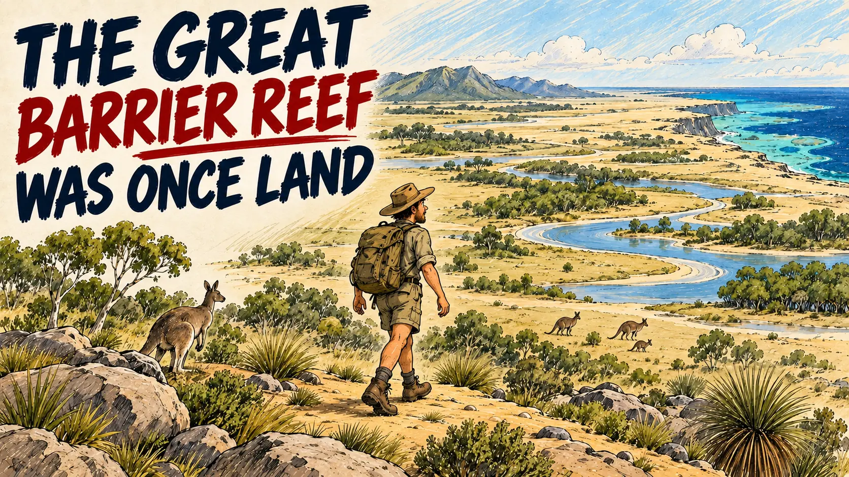
Did you know that 20,000 years ago, you could’ve literally walked across parts of the Great Barrier Reef?
Back during the last ice age, sea levels were over 120 metres lower, leaving behind a sprawling landscape of ancient rivers, lakes, and forests that First Nations people called home.
Fast forward to today, and scientists aboard the RV Investigator—partnering with Darumbal and Woppaburra traditional owners—have used sonar and sediment cores to map this lost world sleeping beneath the waves.
Hit play on today's episode to discover how Australia’s coastline used to look and uncover the fascinating story hidden under the sea!
Tired of feeling lost in conversations with Aussies? My new book, "1001 Australian Slang Words," is your essential guide to understanding and using authentic Aussie slang! Co-created with ESL learners in mind, this comprehensive resource breaks down everyday expressions, making it easier than ever to connect with locals, understand Australian culture, and speak like a true blue Aussie. Don't just learn English – live it! Grab your copy today and start sounding like a local!
Improve your listening skills today – listen, play, & pause this episode – and start speaking like a native English speaker!
Watch & listen!
Listen to today's episode!
Get more out of every episode!
Podcast PLUS members get access to
1500+ episodes with full transcripts
The advanced player with follow-along transcript
Members Only Podcasts you can't hear anywhere else
MP3 + PDF downloads, new episodes every week
Available only for Podcast Plus users.
Transcript of AE 1439 - 5-Minute News: You Could Once Walk Across the Great Barrier Reef!
Pete:
G'day, guys. Pete here from Aussie English. Welcome to today's episode of Five Minute News. So the goal here is to cover a recent news story in around five minutes. Okay, so let's get into it.
Pete:
Picture the Great Barrier Reef today. Clear blue water, coral reefs, islands, fish, boats. Now travel back in time about 20,000 years and take away more than 120m of ocean.
Pete:
Suddenly, parts of the Great Barrier Reef region look completely different. In places where you'd need a boat today, you could have been standing on dry land. And during the long periods when sea levels were lower, this region had rivers, lakes, beaches, forests and estuaries, places where rivers meet the sea. It was a completely different Australian coastline. And people were already here.
Pete:
First Nations people had been living in Australia for tens of thousands of years while these landscapes existed.
Pete:
So what happened to all that land? Well, around 2000 years ago, during the last ice age, huge amounts of the world's water were locked up in ice. So sea levels were much lower than they are today.
Pete:
Then the climate warmed, ice melted, and the ocean rose. But the land didn't suddenly sink beneath the sea. Over thousands of years, the ocean gradually moved across the land. The coastline moved further inland and areas that had once been dry land became submerged, covered by the ocean.
Pete:
By around 7000 years ago, sea level was roughly where it is today. The old landscape was underwater.
Pete:
So if it disappeared thousands of years ago, how can we possibly know what it looked like? Well, that's where this week's news comes in.
Pete:
Thousands of years later, a research ship called the RV Investigator has been floating above the ancient landscape. Researchers recently completed a 24-day expedition to the southern Great Barrier Reef using sonar to map what's hidden below.
Pete:
Sonar uses sound waves to map the sea floor, and with the equipment on this ship, researchers could also investigate the layers underneath it. And there, beneath the modern ocean, they could detect the shapes of an older world.
Pete:
Ancient river channels, lakes, estuaries, beaches. Now, these aren't rivers still flowing underneath the sea. They're the remains of old river channels preserved beneath layers of sediment on the seabed.
Pete:
So scientists are effectively reconstructing a map of a coastline that hasn't existed for thousands of years. But they didn't just map it from above. They also pulled more than 20 long samples, called sediment cores, from the seabed.
Pete:
Think of the seabed slowly building up in layers: sand, mud and other materials settling there over thousands of years. Those layers can preserve information about the environment at different points in the past.
Pete:
Researchers will analyse the cores to learn more about ancient vegetation, climate, changing sea levels, and how the Southern Great Barrier Reef developed over time. And that analysis is still underway.
Pete:
But there's another layer to this story. This expedition wasn't designed by scientists alone. The project was co-designed with Darumbal traditional owners and Woppaburra people, and land and sea country rangers joined researchers aboard the ship.
Pete:
Traditional owners are First Nations people with deep cultural connections and responsibilities to country. They're bringing scientific evidence from sonar and sediment, together with cultural knowledge and songlines; knowledge connecting places, stories and country.
Pete:
That's especially important because this isn't simply the story of an old geological landscape. It's part of a much longer human history of this region.
Pete:
And scientists have only just brought the new data and samples back. They still need to analyse the sediment cores and other data to reconstruct how the landscape changed over thousands of years. But the maps they've already produced reveal something pretty extraordinary.
Pete:
We tend to look at a map of Australia as though that's simply what Australia looks like. But coastlines move, sea levels change, and the map we know today is only one version of Australia. Go back far enough and places where Australians now sail over the Great Barrier Reef were dry land.
Pete:
There were rivers where there's now ocean. And thousands of years after that landscape disappeared beneath the sea. Scientists are beginning to map it again.
Pete:
Okay, so one useful word from today's story is "submerged". If something is "submerged", it's completely underwater. For example, "After the heavy rain, part of the road was submerged."
Pete:
Or in today's story, "Scientists are mapping ancient landscapes that are now submerged beneath the Great Barrier Reef."
Pete:
So "submerged" means completely underwater. Hope you enjoyed this episode today, guys, and I'll see you in the next one.
More podcasts

How Can Someone Steal Money From an Empty Gift Card?
Why Is This Dingo Protected in Victoria but Controlled in South Australia?
Is Australia Really the Best Place to Survive the Apocalypse?